Tuesday, May 31, 2016

Humidity!

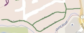
Whew, humid one yesterday. Only about 70 degrees but I actually wrung out my shirt at one point on the way home from my 6 1/2 mile run over to River Farm.
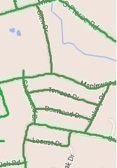
I think that knocks off all of Tanglewood, and I'm getting much closer to having the entire eastern part of EG finished. There are a few outliers off of Post that I hope to knock out this week, then the longer Rt 2 - Frenchtown - Post loop to close out the area north of Frenchtown and East of Rt 2/4.
As you can see from the map, the Western side consists of much more distance, but the density of the roads isn't even close.

I'll continue my commercial for dwMap - this thing is invaluable for my effort here. I map out a few courses in advance to ensure I'm covering dead ends and optimizing my route - limiting retracing my steps, for example - and then choose a route that's got the distance I'm feeling comfortable covering each day that I run. Definitely saves me from the problem I described a few posts ago, where I'm blindly guessing (and wildly underestimating) my distance and the duration of my runs.

Saturday, May 28, 2016

Heat!

I'm not a fan of the heat. Before heading to Mexico, it was 60 with enough wind to make it feel much cooler than that. Returned from Mexico and it's in the 80s with no breeze whatsoever. Not conducive to long runs.

Went out on a short one on Thursday to knock out a small road, Frybrooke, off Middle across Rt 2 from me - turned out to be a private road, but I didn't have anywhere else to go for a quick run at lunchtime so I bit the bullet and did it anyway.
This morning, I went for a more aggressive run - about 6.25 miles - and knocked out an area in Tanglewood but deeper in, almost over to Post Road.
Couldn't get up early enough to venture out Division past the highway on/off-ramps so stuck to this side of Rt 2 again. Maybe tomorrow or Monday morning...

Here's the full map to date.


Tuesday, May 24, 2016

Back from Mexico

Quiet week - went to Mexico for 5 days for my niece's wedding. Had an awesome time, but it wasn't very runner friendly - the road was way too tight to comfortably run, and I've never been a beach runner. Not to mention the morning temps were in the high 70s, so it would have been a struggle. So, I sat on my butt and ate a lot of awesome food.

Back in the saddle again yesterday, though - put in almost 6 miles to knock off a bunch of streets over near Hanaford elementary school.

That makes the overall map look like the following - getting very close to finishing everything NE of Rt 4 and Frenchtown.

Sunday, May 15, 2016

Figured out a couple things

First thing I figured out... I can get past this blood donation weakness thing by following the standard runner's mantra of not going out too fast. The first 3-4 times I ran after donating, I went out at my usual pace and burned out pretty quickly. This morning, I knew what I was in for and started off slow and steady. I essentially had a negative split, aside from mile 7 which included the run up Middle Rd from Rt 2 - a hefty hill that I can't fault myself for slowing down on...
Nothing wrong with that... Those times as a whole aren't great compared to my pre-donation pace, but they are light years ahead of the struggles I've had for the past 2 weeks - I never slowed down or walked unlike all other runs since the blood donation.

The next thing I figured out is that running the Division section with the Rt 95 and Rt 4 on/off ramps is just fine before 6 AM on a Sunday (and probably Saturday). I left the house this AM at 5:45 and made it through that section without issue on my way west of Rt 2.

Pretty slow week - I knocked out another portion of the Tanglewood area on Weds then took some time off to recover.

This morning's 8 mile run was to finish off Stone Ridge. A TON of houses for sale back there - beautiful neighborhood with some houses that back up to the EG golf course. Very similar in design to the Cindyann neighborhood, so I'm thinking it might have been the same builder...

Overall, here's what the map is looking like:
I'm focusing on north of Middle (long runs) and east of Rt 4 (medium / long runs). I think that might build up my endurance enough to venture southwest...

One other thing I'll point out before I wrap up. My new Garmin watch can download apps, and I pulled down something calls dwMap. It's fantastic for this endeavor - it allows me to map out my runs on a website and then push the map to my watch. That is priceless when it comes to all the backtracking, dead-ends, etc. - there are some cases where I can't remember if the dead-end that I need to knock off is straight ahead or to the left, and heading to the non-dead-end means a return trip to that area to simply cross off the dead-end. It also incorporates all of the standard Garmin tracking - speed, distance, pace, heart rate, etc. - so it's a very nice bonus. I've considered carrying a piece of paper with turn-by-turn instructions, but this seems to be footing the bill for me. More about it here: http://dynamic.watch/.
Tuesday, May 10, 2016

I'm a horrible estimator...

Went out for a couple runs over the past week and did a horrendous job of guessing the distance of those runs. The first was written up in my last post, the "I need to finish Hill and Harbor" that turned into an 8 mile endeavor... Next up was a short run where I knocked off a little neighborhood of mostly patio homes tucked into a corner of Middle Rd and Rt 2.

Then we get into my problem area. My wife asked where I was running and when I'd be back - I said "Queen's Grant, and it's only 3-4 miles". Well, 5+ miles later...

Then yesterday I went out for what I thought might be 5-6 miles through the southern part of Stone Ridge. Nope, 7.6 miles. I think I'll just have to add 2 miles to every estimate that I don't meticulously measure via Map My Run or something like that.
Stone Ridge was my first run on the other side of Rt 2 EVER - I've biked over there a few times, but never run that way. Just the first of many...

I got a new Garmin late last week - an FR235 - which is very fun. More accurate than my old one (a 5 year old FR405CX) with many more bells and whistles - steps, heart rate, VO2 Max calculations, etc. It told me that I'd need 50+ hours to recover after my Queen's Grant run (I ran 24 hours later) and 72 hours after yesterday's Stone Ridge run (I'll probably run a short one today or tomorrow). I'm hoping those calculations are a result of my diminished aerobic capacity due to donating blood - it's supposed to take 16 weeks until my red blood cell count is all the way back to where it was before I donated - but I might just be oblivious to my true state of fitness :)

Here's the full map:

Thursday, May 5, 2016

Cold for May...

Went out with an optimistic goal to knock off the remaining Hill and Harbor roads on Monday - I didn't want to leave anything untouched lest I need to revisit the 4 mile round trip just to cover 1/4 mile. Unfortunately, I didn't consider the length of the run required to cover the remaining roads - it turned out to be an 8 mile round trip. Probably something I could have handled on a normal day, but I donated blood the prior day - double red donation, no less - so I was struggling early and often. I think I probably walked a mile or more, but I achieved my goal - all of Hill and Harbor is DONE! I also knocked off a few streets on the east side of Post Rd in the area to really make sure I wouldn't have to run down Division in that direction again. I don't think my body has fully recovered from the cold yet - I caught a dry window, but the temp and wind was rough and I am still feeling the cold 3 days later.

Here's a look at the completed area in the northeast part of town.


Still a LARGE amount of area to cover, especially west of Rt 4, but the concentration of roads in this section of town is significantly greater than any other area of town, which makes me feel like I've made significant progress and gives me hope that I can achieve my goal as long as I can continue to run injury-free and add distance / endurance to my runs.